


Voting District 0438552000001, Dickinson County, Michigan
About
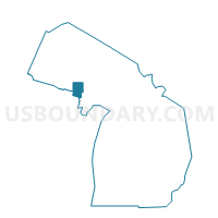
Outline

Summary
| Unique Area Identifier | 596355 |
| Name | Voting District 0438552000001 |
| County | Dickinson County |
| State | Michigan |
| Area (square miles) | 111.85 |
| Land Area (square miles) | 111.46 |
| Water Area (square miles) | 0.39 |
| % of Land Area | 99.65 |
| % of Water Area | 0.35 |
| Latitude of the Internal Point | 46.15892600 |
| Longtitude of the Internal Point | -87.71223670 |
Maps


Graphs
Select a template below for downloading or customizing gragh for Voting District 0438552000001, Dickinson County, Michigan


Neighbors
Neighoring Voting District (by Name) Neighboring Voting District on the Map
- Voting District 0431020000001, Dickinson County, MI
- Voting District 0432766000001, Dickinson County, MI
- Voting District 1032582000001, Marquette County, MI
- Voting District 1032972000003, Marquette County, MI
- Voting District 1037978000001, Marquette County, MI
- Voting District 1038526000001, Marquette County, MI
Top 10 Neighboring County Subdivision (by Population) Neighboring County Subdivision on the Map
- Forsyth township, Marquette County, MI (6,164)
- Ely township, Marquette County, MI (1,952)
- Tilden township, Marquette County, MI (1,013)
- Felch township, Dickinson County, MI (752)
- Breen township, Dickinson County, MI (499)
- Wells township, Marquette County, MI (231)
- West Branch township, Dickinson County, MI (63)
Top 10 Neighboring Elementary School District (by Population) Neighboring Elementary School District on the Map
Top 10 Neighboring Unified School District (by Population) Neighboring Unified School District on the Map
- Gwinn Area Community Schools, MI (9,903)
- N.I.C.E. Community Schools, MI (7,030)
- North Dickinson County Schools, MI (2,420)
Top 10 Neighboring State Legislative District Lower Chamber (by Population) Neighboring State Legislative District Lower Chamber on the Map
Top 10 Neighboring State Legislative District Upper Chamber (by Population) Neighboring State Legislative District Upper Chamber on the Map
Top 10 Neighboring 111th Congressional District (by Population) Neighboring 111th Congressional District on the Map
Top 10 Neighboring Census Tract (by Population) Neighboring Census Tract on the Map
- Census Tract 22, Marquette County, MI (3,117)
- Census Tract 26, Marquette County, MI (2,405)
- Census Tract 9501, Dickinson County, MI (1,743)